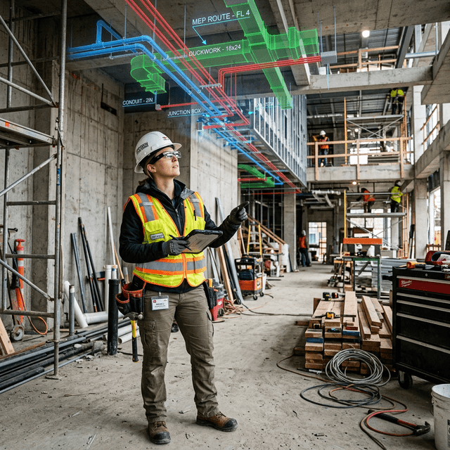
MEP installation coordination
Review routes, connection points, access constraints, and installation sequences for dense mechanical, electrical, and plumbing work before and during site execution.
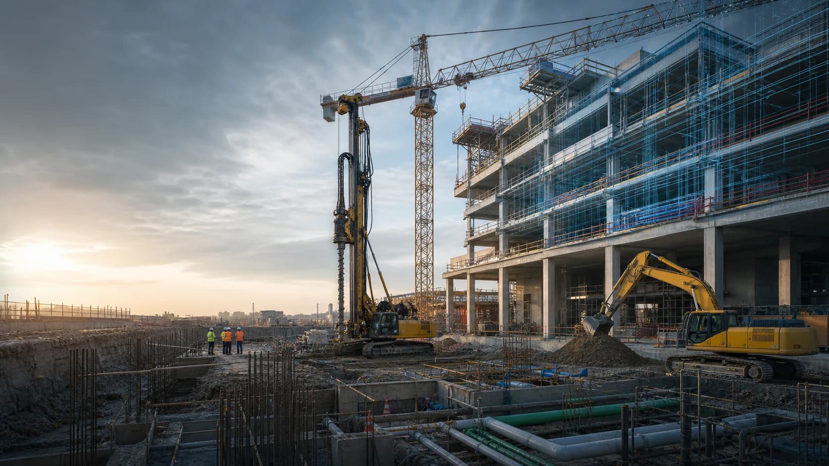
Turn design intent into field-ready guidance
Bring BIM, spatial context, guided procedures, and field evidence to the point of work so construction teams can coordinate installation, identify deviations earlier, and preserve a traceable handover record.
Connect data, workflows, and field execution so teams can understand context, act faster, and keep work traceable.
Prepare BIM, CAD, point clouds, equipment models, and site context in FactVerse Designer so teams can review locations, routes, clearances, and work areas together.
Use Director to organize approved 3D content, instructions, checks, and reference material into step-by-step installation or commissioning guidance.
Deliver spatial content and procedures through DataMesh One on supported mobile or head-mounted devices selected for the site environment.
Give owners, designers, contractors, and field teams a shared spatial view for reviewing interfaces, work sequences, access, and handoffs.
Use Inspector workflows to capture checks, photos, deviations, corrective actions, and acceptance records against the relevant asset or work area.
Carry asset context, installation records, approved procedures, and acceptance evidence into later inspection, maintenance, training, and renovation workflows.
Practical applications and proven success scenarios across industries.
Review routes, connection points, access constraints, and installation sequences for dense mechanical, electrical, and plumbing work before and during site execution.

Combine existing-site context with proposed work so teams can explain the change, coordinate affected systems, and prepare the execution sequence.
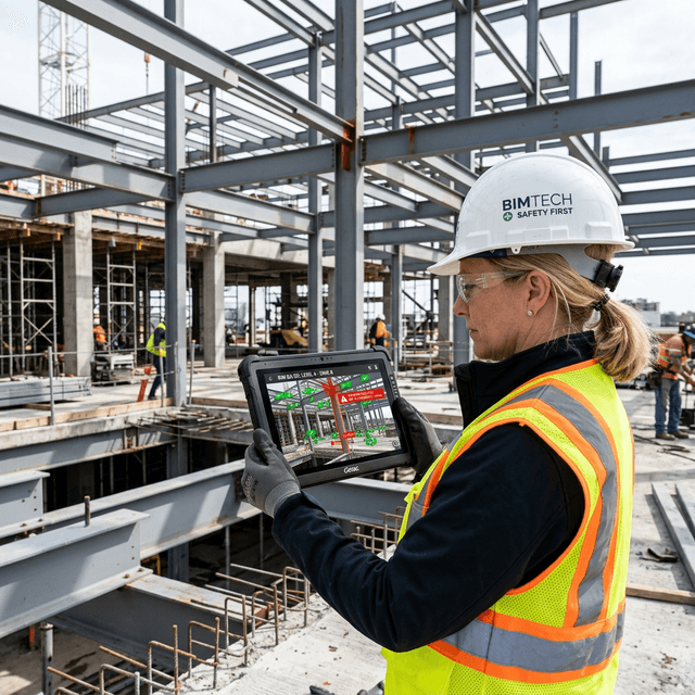
Review completed work against approved spatial context, record visible deviations or obstructions, and route corrective work with supporting evidence.

Use interactive 3D context to align owners, designers, contractors, and field teams around the same zone, sequence, and acceptance expectations.
Construction teams already have drawings, BIM models, issue lists, method statements, photos, and inspection records. At the point of work, crews still need to understand the exact location, surrounding systems, approved sequence, and acceptance requirement. When that context is fragmented, coordination problems and deviations are often discovered late.
Construction Guidance connects the spatial model, guided work, and field evidence. Teams can prepare the relevant site context, deliver approved procedures where the work happens, and retain a record of what was checked, changed, and accepted.
FactVerse Designer owns scene preparation and spatial planning. Director owns the guided procedure and presentation of approved work instructions. DataMesh One is the field delivery experience. Inspector owns inspection, issue, work, and evidence records. FactVerse provides the common asset, spatial, and operational context that connects these activities.
Each stage uses the appropriate tool, with clear ownership for content, field execution, and records throughout the construction workflow.
MEP corridors, equipment rooms, hidden works, retrofit areas, complex installation sequences, commissioning checks, and owner handover are practical starting points. These areas have dense spatial relationships, multiple teams, and a clear need for shared context and traceable evidence.
Field delivery can use supported mobile or head-mounted devices. The choice is made against site safety rules, lighting, connectivity, required interaction, spatial accuracy, and user comfort. Large source models are prepared around the work area and required level of detail, then tested with representative data and real site conditions during the pilot.
The record created during construction can support the operating life of the asset. Locations, installation photos, approved procedures, acceptance results, deviations, and corrective history can inform inspection, maintenance, training, renovation, and emergency-response preparation after handover.
DataMesh has supported BIM and mixed-reality workflows with JTC, building-construction digital twin workflows with Obayashi, and construction simulation with Toda for SAGA Arena. The TOKYO TORCH project also shows how spatial content can help stakeholders understand and communicate a complex future environment.
A focused pilot should use one representative area, one approved procedure, the intended field device, and a defined verification record. The acceptance plan can then test model preparation, site alignment, guidance usability, evidence capture, and handover before the workflow expands to additional trades or locations.
Projects can combine BIM, CAD, point clouds, equipment models, photos, work instructions, issue records, and acceptance requirements. The pilot confirms the supported import path, model preparation effort, and data ownership for the actual source files.
DataMesh One can deliver approved content through supported mobile and head-mounted devices. Device selection depends on the work area, safety policy, lighting, connectivity, interaction method, and required spatial accuracy, and is validated during the pilot.
The team selects the relevant building zone, systems, assets, and level of detail, then optimizes the content for the target device and field workflow. Acceptance tests use the customer's representative models and site conditions.
FactVerse Designer prepares the spatial scene, Director authors guided procedures, DataMesh One delivers them in the field, and Inspector manages checks, issues, work records, and evidence. FactVerse keeps the shared asset and spatial context.
Yes. Approved asset context, procedures, photos, deviations, acceptance records, and issue history can support later inspection, maintenance, training, renovation, and emergency-response preparation.
Continue with the most relevant products, solutions, guides, and public references for this topic.